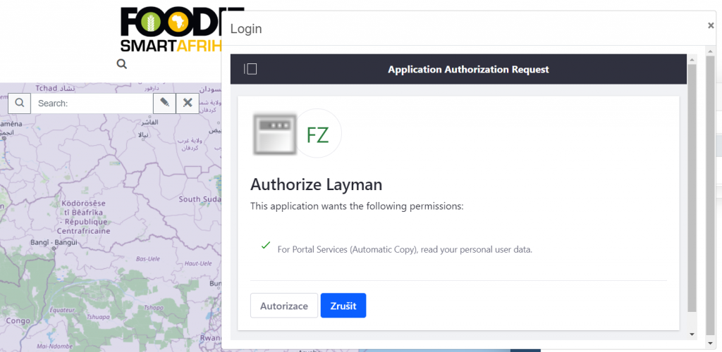
Pilot implementation of HSLayers-NG connection to the Layman catalogue has been developed as a part of the remote phase of Kampala Inspire hackathon 2020 (https://www.plan4all.eu/kampala-inspire-hackathon-2020/). Layman is a web tool for publishing vector data through REST API and allows other applications to integrate to it via OAuth2 standard. The presented integration allows user to view the data and after authorization to save Shapefile data and/or map compositions to Layman and load them later from the catalogue to the map. It is also possible to directly share your map composition to the most common social networks.
See the Smart Agri Hub portal here.